Malanville
Malanville is a city, arrondissement and commune in the Alibori Department of northeastern Benin, located across the River Niger from Niger. It is known as a centre of cross-border trade and has a major market. Malanville is also a centre for rice-growing. The commune covers an area of 3016 square kilometres and as of 2013 had a population of 168,006 people.
Malanville has an extremely diverse population consisting of a large Muslim community, large Christian community, French speakers and speakers of local languages, as well as several practitioners of local religions. The cuisine is a mixture of African and European. Despite the differences that exist between these groups, they live side by side in peace and share public and private sector responsibilities.
Malanville has an extremely diverse population consisting of a large Muslim community, large Christian community, French speakers and speakers of local languages, as well as several practitioners of local religions. The cuisine is a mixture of African and European. Despite the differences that exist between these groups, they live side by side in peace and share public and private sector responsibilities.
Map - Malanville
Map


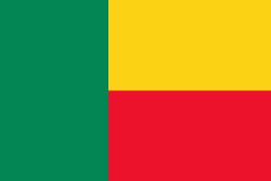
Country - Benin
 |
 |
| Flag of Benin | |
From the 17th to the 19th century, political entities in the area included the Kingdom of Dahomey, the city-state of Porto-Novo, and other states to the north. This region was referred to as the Slave Coast from the early 17th century due to the high number of people who were sold and trafficked during the Atlantic slave trade to the New World. France took over the territory in 1894, incorporating it into French West Africa as French Dahomey. In 1960, Dahomey gained full independence from France. As a sovereign state, Benin has had democratic governments, military coups, and military governments. A self-described Marxist–Leninist state called the People's Republic of Benin existed between 1975 and 1990. In 1991, it was replaced by the multi-party Republic of Benin.
Currency / Language
| ISO | Currency | Symbol | Significant figures |
|---|---|---|---|
| XOF | West African CFA franc | Fr | 0 |
| ISO | Language |
|---|---|
| FR | French language |